Property Record
4071 Redan Rd, Stone Mountain, GA 30083


NEARBY LISTINGS FOR SALE OR LEASE
Property Detail
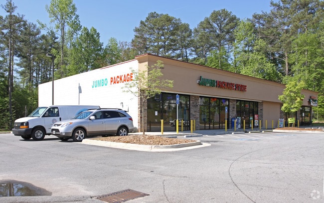
4071 Redan Rd
15-221-08-046
63 X 130 X 228 X 178 X 228 0.99AC 5-29-9
Storebuilding
DeKalb
X
Georgia
13089C0088J
46
2025
0.99 AC
2025
Stone Mtn/Clarkston
023111
Atlanta
7,440 SF
Atlanta-Sandy Springs-Roswell, GA
DEMOGRAPHICS near 4071 Redan Rd
1 Mile
3 Mile
5 Mile
2024 Total Population
10,719
102,049
276,265
2029 Population
10,764
101,782
276,110
Pop Growth 2024-2029
+ 0.42%
(0.26%)
(0.06%)
Average Age
39
39
39
2024 Total Households
4,080
38,307
106,850
HH Growth 2024-2029
+ 0.51%
(0.16%)
+ 0.07%
Median Household Inc
$45,489
$51,985
$60,007
Avg Household Size
2.50
2.50
2.50
2024 Avg HH Vehicles
1.00
2.00
2.00
Median Home Value
$202,090
$210,732
$249,996
Median Year Built
1977
1976
1977
Nearby Places
Map Layers
Map Styles
 Street
 Aerial
- Restaurants
- Banks
- Shops
- Fitness
- Groceries
PUBLIC TRANSPORTATION
TRANSIT/SUBWAY
Indian Creek (Blue Line - Metropolitan Atlanta Rapid Transit Authority (MARTA))
DRIVE
WALK
Distance
Indian Creek (Blue Line - Metropolitan Atlanta Rapid Transit Authority (MARTA))
4 min
16 min
0.9 mi
AIRPORT
Hartsfield - Jackson Atlanta International
DRIVE
WALK
Distance
Hartsfield - Jackson Atlanta International
28 min
18.1 mi
Nearby Properties
Address
Land Use
TOTAL SIZE
Lot Size
Zoning
Address
Land Use
TOTAL SIZE
Lot Size
Zoning
78,008 SF
11.16 AC
HR-3
Address
Land Use
TOTAL SIZE
Lot Size
Zoning
988,394 SF
102.84 AC
RM100
Address
Land Use
TOTAL SIZE
Lot Size
Zoning
287,674 SF
17.63 AC
R75: SF RE
Address
Land Use
TOTAL SIZE
Lot Size
Zoning
350,556 SF
46.09 AC
X
Address
Land Use
TOTAL SIZE
Lot Size
Zoning
455,599 SF
43.15 AC
HR-3
Address
Land Use
TOTAL SIZE
Lot Size
Zoning
295,718 SF
25.64 AC
RM85
Address
Land Use
TOTAL SIZE
Lot Size
Zoning
76,500 SF
2.84 AC
X
Address
Land Use
TOTAL SIZE
Lot Size
Zoning
319,984 SF
24.70 AC
RM100
Address
Land Use
TOTAL SIZE
Lot Size
Zoning
234,053 SF
16.80 AC
RM75
Address
Land Use
TOTAL SIZE
Lot Size
Zoning
251,327 SF
19.92 AC
X
Address
Land Use
TOTAL SIZE
Lot Size
Zoning
269,639 SF
24.65 AC
RM100
Address
Land Use
TOTAL SIZE
Lot Size
Zoning
396,905 SF
20.82 AC
RM85
Address
Land Use
TOTAL SIZE
Lot Size
Zoning
137,176 SF
17.59 AC
RM85
Address
Land Use
TOTAL SIZE
Lot Size
Zoning
446,287 SF
31 AC
RM100
Address
Land Use
TOTAL SIZE
Lot Size
Zoning
71,208 SF
15 AC
X
Address
Land Use
TOTAL SIZE
Lot Size
Zoning
180,410 SF
14.50 AC
RM85
Address
Land Use
TOTAL SIZE
Lot Size
Zoning
312,258 SF
24.80 AC
X
Address
Land Use
TOTAL SIZE
Lot Size
Zoning
384,545 SF
35.93 AC
RM100
Address
Land Use
TOTAL SIZE
Lot Size
Zoning
158,939 SF
14.09 AC
RM85
Address
Land Use
TOTAL SIZE
Lot Size
Zoning
273,192 SF
24.07 AC
RM100
Address
Land Use
TOTAL SIZE
Lot Size
Zoning
285,494 SF
19.35 AC
Address
Land Use
TOTAL SIZE
Lot Size
Zoning
495,922 SF
30.90 AC
RM100
Address
Land Use
TOTAL SIZE
Lot Size
Zoning
256,445 SF
11.71 AC
RM85
Address
Land Use
TOTAL SIZE
Lot Size
Zoning
244,898 SF
15 AC
RM85
Address
Land Use
TOTAL SIZE
Lot Size
Zoning
221,594 SF
15.90 AC
RM85
Address
Land Use
TOTAL SIZE
Lot Size
Zoning
191,565 SF
17.40 AC
RM85
Address
Land Use
TOTAL SIZE
Lot Size
Zoning
23,072 SF
5.48 AC
C1
Address
Land Use
TOTAL SIZE
Lot Size
Zoning
118,371 SF
15 AC
R75
Address
Land Use
TOTAL SIZE
Lot Size
Zoning
96,566 SF
10.51 AC
Address
Land Use
TOTAL SIZE
Lot Size
Zoning
277,816 SF
18.15 AC
RM100
The World's #1 Commercial Real Estate Marketplace
Connect with us
© 2026 CoStar Group
The information above has been obtained from sources believed reliable. While we do not doubt its accuracy we have not verified it and make no guarantee, warranty or representation about it. It is your responsibility to independently confirm its accuracy and completeness. Any projections, opinions, assumptions, or estimates used are for example only and do not represent the current or future performance of the property. The value of this transaction to you depends on tax and other factors which should be evaluated by your tax, financial, and legal advisors. You and your advisors should conduct a careful, independent investigation of the property to determine to your satisfaction the suitability of the property for your needs.